
Eco-index Essentials
Basic products that provide understanding of biodiversity status by showing current ecosystem cover and what landscapes would look like if people never arrived in Aotearoa New Zealand. These products can form a biodiversity baseline for your area and suggest targets for biodiversity investment.
Eco-index Essentials Collection:
Land Cover Snapshot
Ecosystem Projector
Land Cover Snapshot
The Land Cover Snapshot identifies current land cover in four categories. See our Digital Product Guide for definitions.
Mature Ecosystems
Regenerating Ecosystems
Reconstruction Opportunity
Built-up and Transport Areas
The Land Cover Snapshot can be used to calculate current native ecosystem cover, which can be considered a biodiversity baseline. It identifies where ecosystems are regenerating on their own, and determines where interventions like large scale ecosystem reconstruction could occur, thereby creating biodiversity investment targets.
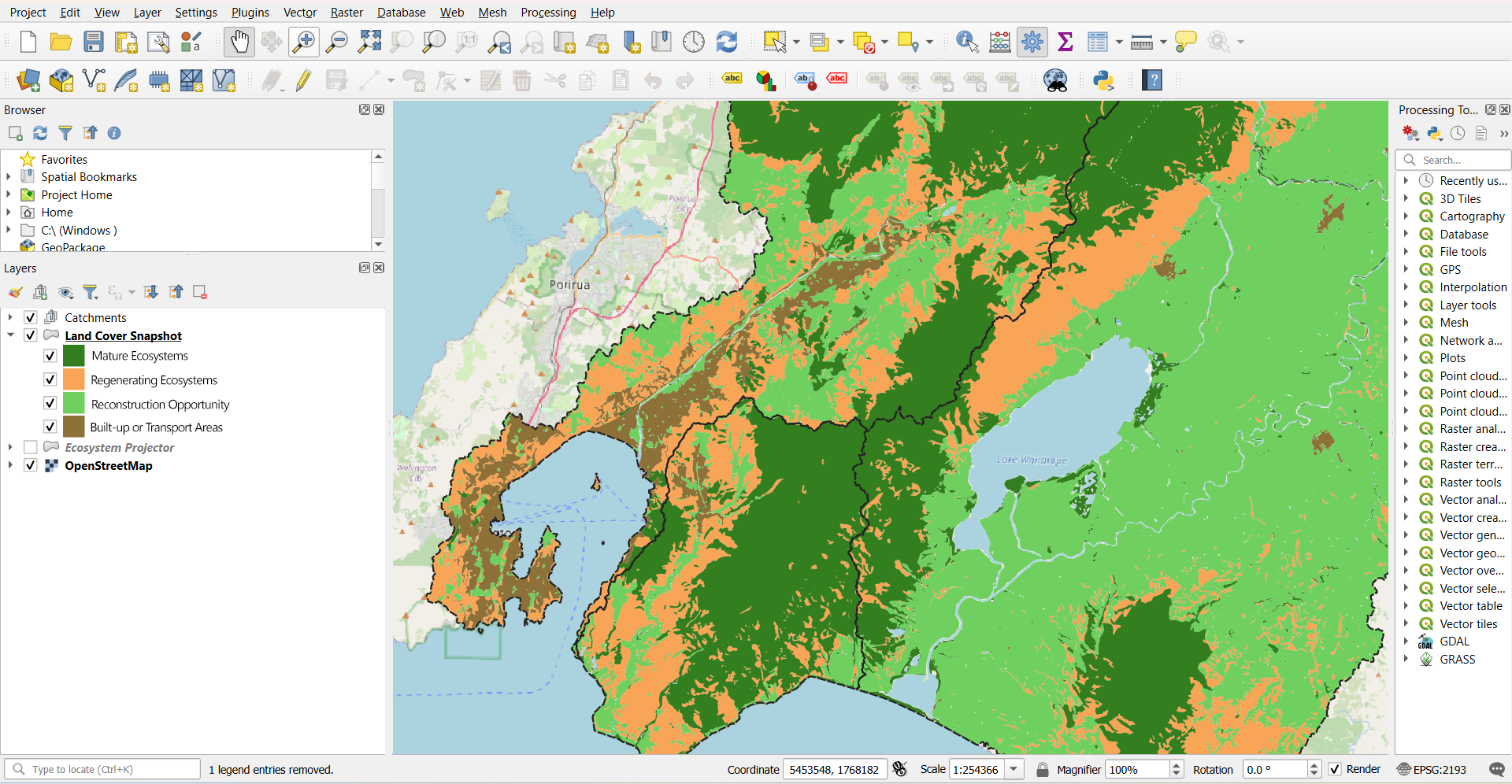
Screenshot of the Land Cover Snapshot for the lower North Island. This product is operated using GIS software.
There is a fee to have the Land Cover Snapshot customised to your own area of interest, please get in touch for a quote.
The Land Cover Snapshot’s data is integrated into our Navigator product, so there's no need to purchase it separately.
You can integrate this product with your own GIS system and layers of interest to create your own specific decision support guidance.
Product design and underlying data details are available in our Product Deep Dive.
Ecosystem Projector
The Ecosystem Projector shows what Aotearoa New Zealand would look like if people never arrived here. It indicates which and where native ecosystems are suitable for reconstruction. The Ecosystem Projector can generate maps showing where native ecosystem types are expected to naturally occur across a landscape of interest, as well as summary metrics such as the area (ha) of each expected ecosystem type (see our Digital Product Guide for example metrics).
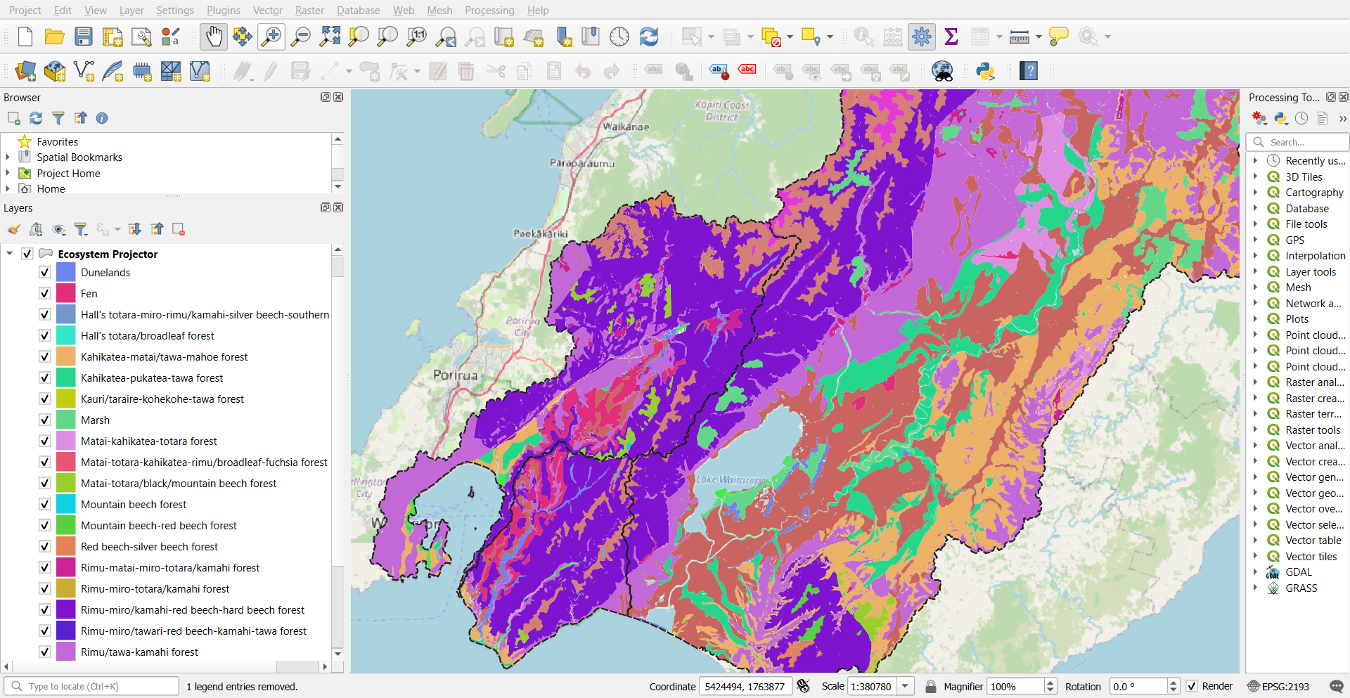
Screenshot of the Ecosystem Projector for the lower North Island. This product is operated using GIS software.
Visit the Ecosystem Reconstruction Map to view the Ecosystem Projector at national scale
Visit the Eco-index Data Service to download the Ecosystem Projector at national scale
There is a fee to have the Ecosystem Projector customised to your own area of interest, please get in touch for a quote.
The Ecosystem Projector data is integrated into our Navigator product, so there's no need to purchase it separately.
You can integrate this product with your own GIS system and layers of interest to create your own specific decision support guidance.
Product design and underlying data details are available in our Product Deep Dive.