
This product is free to download.
Ecosystems deliver essential services that underpin economic, environmental, and community wellbeing. These include cleaner water and air, carbon storage, flood and fire risk reduction, and the provision of food, timber, and medicines. When ecosystems are thriving, they reduce exposure to natural hazards and strengthen climate resilience - outcomes matter to all of us.
The Ecosystem Services Valuer helps you understand these benefits in monetary terms, so they can be considered alongside traditional financial metrics. It enables you to compare scenarios, assess trade-offs, and identify where nature-based solutions can deliver the greatest return - whether you are managing existing landscapes or planning restoration and development.
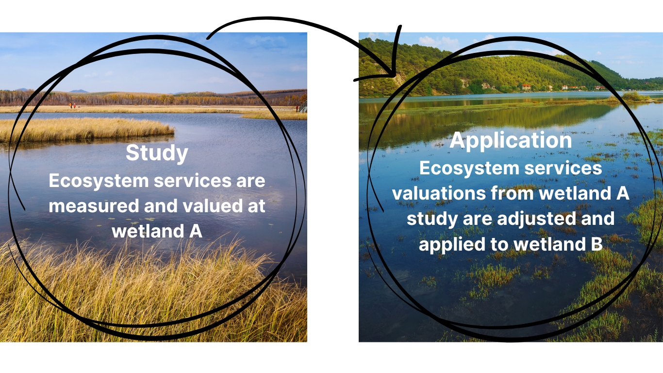
Using a benefit transfer approach grounded in thousands of peer-reviewed studies worldwide*, the Ecosystem Services Valuer has been developed to provide values for the ecosystems found in Aotearoa New Zealand. It can be applied to ecosystems that currently exist in your landscape or those you’re considering reconstructing.
The result is clearer evidence to support investment decisions, policy design, and long-term planning; helping you align environmental outcomes with financial and risk management objectives.
Ecosystem Services Valuer
The Benefit Transfer Approach to Ecosystem Service Valuation
From our Economist
“The power of monetary valuation lies in its ability to increase visibility. It brings the hidden wealth of nature into the view of markets. Fortunately, it is very difficult to privatise this value, and that is not the aim of valuation. What it does do is communicate importance.”
- Dr Jay Whitehead, Eco-index Economist - Read more in How much is a mountain worth?
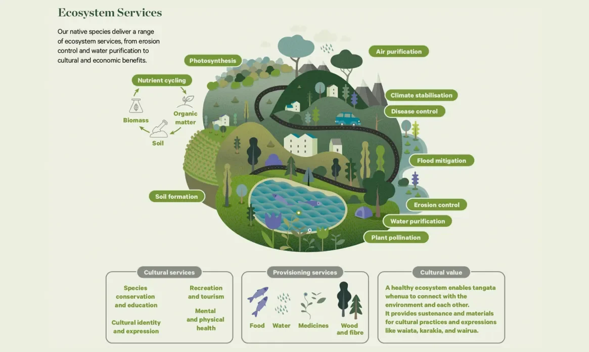
Overview of Ecosystem Services. Source: Aotearoa Circle. Click to expand.

Screenshot of Ecosystem Services Valuer tool, showing yellow selected polygon and the table of ecosystem service valuations. Click to expand.
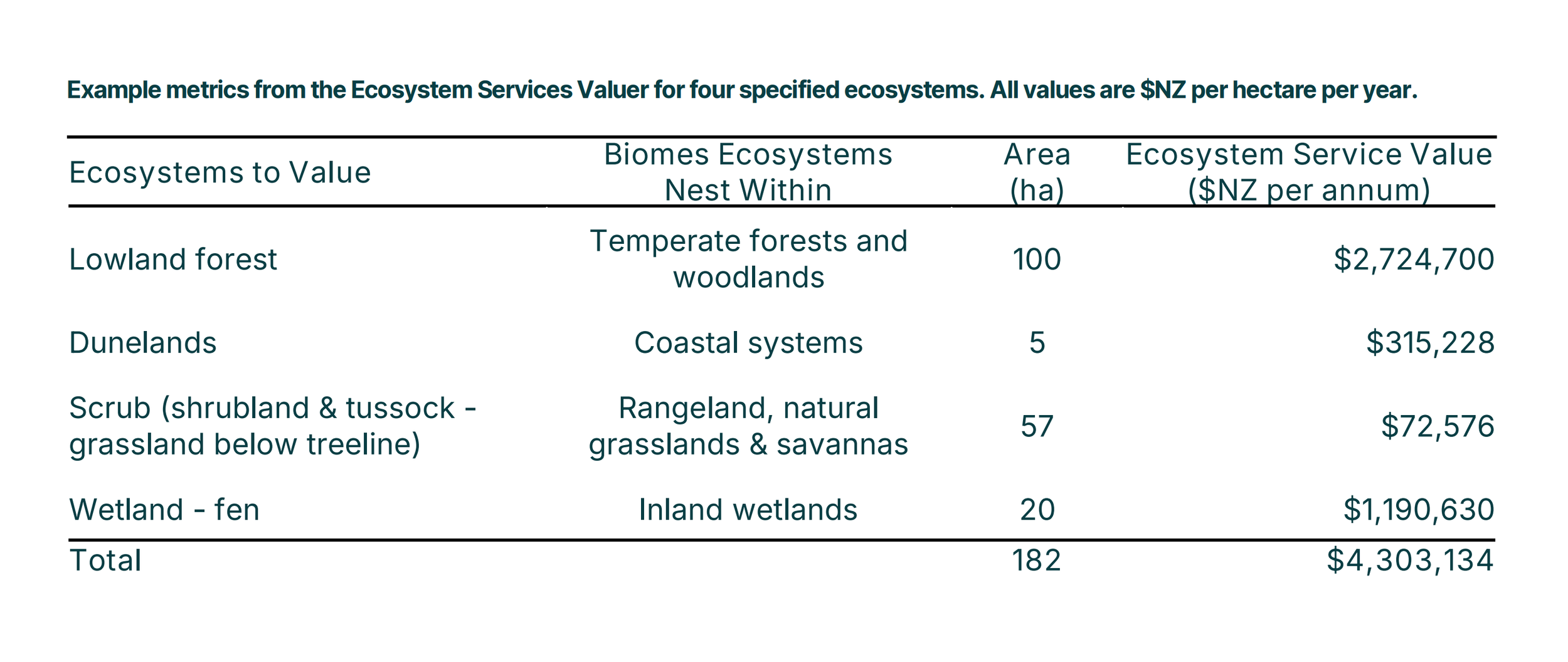
Ecosystem services are valuable! This table presents data for four native ecosystems. Click to expand.
How does the Ecosystem Services Valuer work?
The Ecosystem Services Valuer is a GIS database that provides $NZD valuations for 23 different ecosystem services. These valuations are provided for seven biomes that comprise a total of 33 different native ecosystems. The Ecosystem Service Valuer can be applied to existing native ecosystems in your landscape, as well as ecosystem types that you’re considering reconstructing. The values are per hectare, per year and are intended to represent broad-scale benefits.
* Brander, L.M., de Groot, R., Schägner, J.P., Guisado Goñi, V., van't Hoff, V., Solomonides, S., McVittie, A., Eppink, F., Sposato, M., Do, L., Ghermandi, A., Sinclair, M., Thomas, R. (2024). Economic values for ecosystem services: A global synthesis and way forward. Ecosystem Services, 66, 101606.
Explore UNEP Nature-based Solutions Resources.
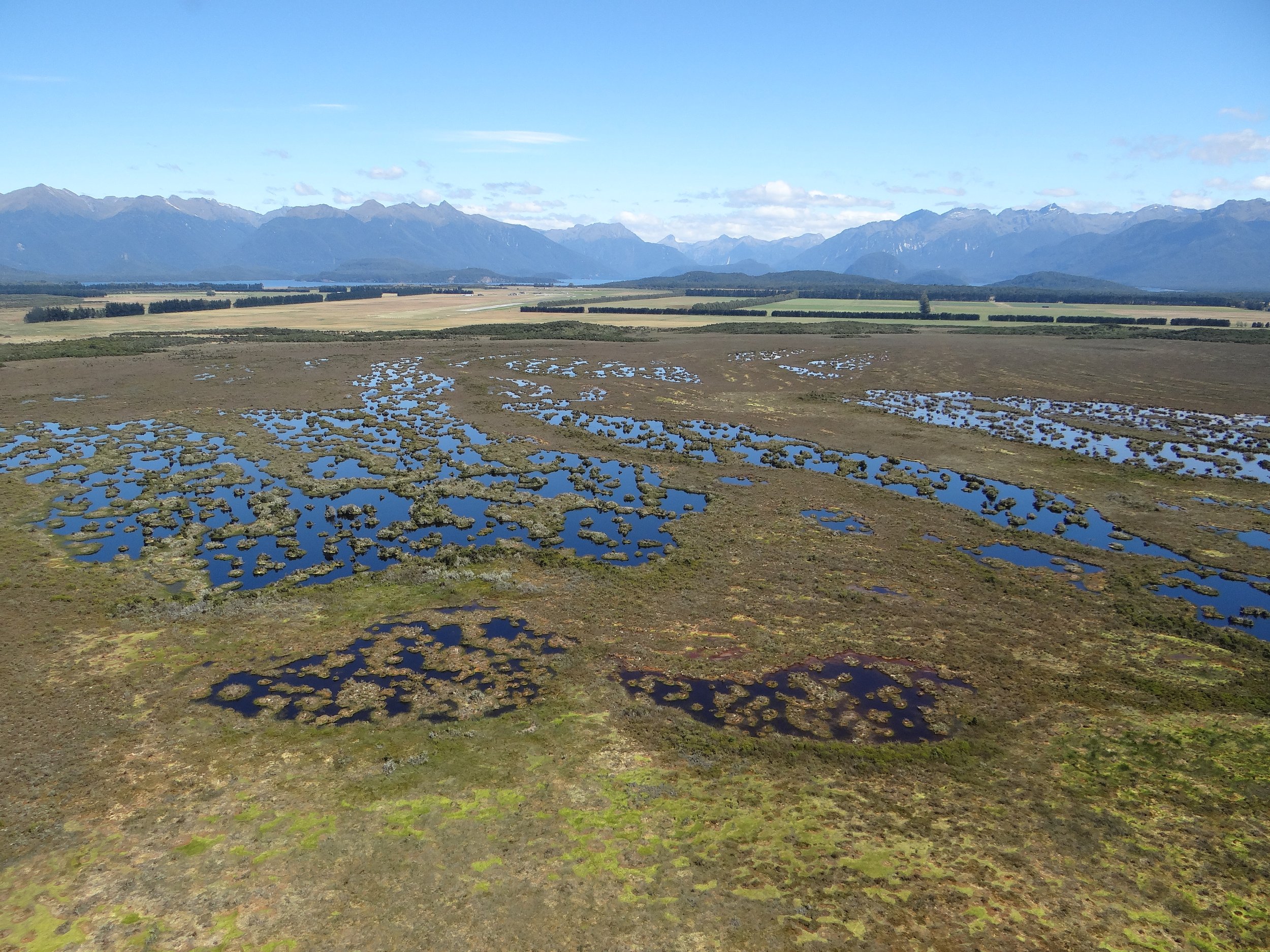
Banner image: Karen Denyer