

Navigating Planting Potential in Taranaki
Case Study: Taranaki Mounga Project
The Context
Taranaki Mounga Project
is a collaborative effort aimed at restoring the natural biodiversity of the Taranaki region in Aotearoa New Zealand. It involves multiple community and iwi/hapū-based partners working to revive native ecosystems and manage the landscape sustainably.
With aligned aspirations to weave knowledge and people for the benefit of Te Taiao, Taranaki Mounga Project and Eco-index have been working together since 2023. Together, they are providing data and tools to help iwi, hapū and communities identify high-impact restoration zones - guided by data, driven by people.
| Partners | Taranaki Mounga Project Te Ihowai Limited Community and Iwi/Hapū groups |
| Challenge | Planning large scale ecological restoration |
| Eco-index Solutions |
Navigator & Navigator X |
| Outcome | Improved planning & prioritisation power through science-based mapping |
| Project Supporters |
Biological Heritage NZ Biome Trust Imaginal Seeds Trust Te Mauri o Te Taiao Trust |
| Date | 2023 - ongoing |
The Challenge
The Taranaki Mounga Project aims to restore the ecological vitality of the Taranaki region, encompassing the mountain, ranges and islands. It’s a partnership with Te Papa Atawhai / Department of Conservation, funders and the Taranaki Iwi Chairs Forum.
The Project team work with multiple community and iwi/hapū groups, like that of Te Ihowai Limited, to transform the area by removing introduced invasive species, reintroducing native plant and bird species, and protecting threatened species. A significant challenge for the Taranaki Mounga Project and its partners has been determining where to focus restoration efforts to achieve the most substantial ecological impact, especially in areas where native ecosystems have been lost.
“A lot of technology advances have helped make our work easier - the mapping tools from Eco-index are some of those game-changing advances.”
The Solution
With philanthropic support, Eco-index built two digital tools to meet the mapping and data needs of Taranaki Mounga Project and it’s partners:
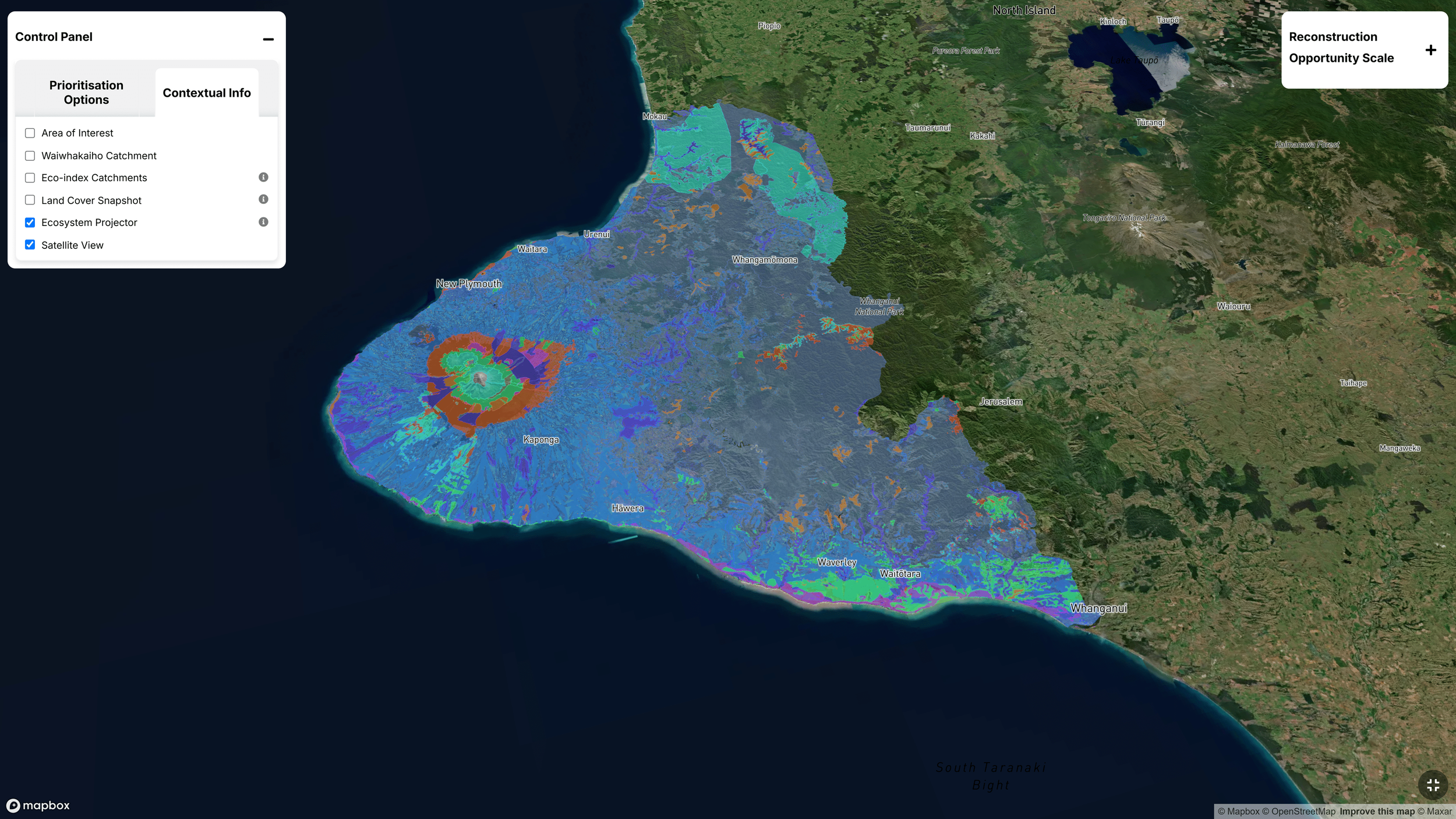
Navigator is a GIS-based tool that identifies optimal locations for reconstructing native ecosystems based on priorities set by the user. Eco-index Data Scientists, Ecologists and Economists brought together a range of national environmental datasets and expert know-how to create a sophisticated tool that highlights areas where ecosystem reconstruction efforts would yield the highest biodiversity benefits.
Navigator X is the browser-based version of Navigator, allowing users to fly and zoom through their area of interest, without the need for GIS software or skills. Navigator X is a valuable communication and collaboration tool that allows non-technical users to customise and explore ecosystem reconstruction guidance.
Dr. Kiri Joy Wallace, Eco-index Co-Director, explains:
"Navigator and Navigator X help people to identify the best 'bang-for-buck' places to reconstruct native ecosystems from scratch. We've designed these tools to help organisations like Taranaki Mounga Project and Te Ihowai Limited maximise the chance of supporting their local biodiversity while effectively using their precious time and resources."
Navigator (2D GIS mapping tool) showing a heat map for potential ecosystem restoration in the Waiwhakaiho catchment.
Navigator X (3D browser-based mapping tool) showing different native ecosystems suitable for restoration around Taranaki.
Navigator X (3D browser-based mapping tool) showing a heat map for potential ecosystem restoration around Taranaki Mounga.
The Impact
Strategic Planning
Navigator and Navigator X has become an integral part of restoration planning for Taranaki Mounga Project and partners. It enables them to prioritise areas that offer the most significant ecological benefits.
Enhanced Collaboration
The user-friendly Navigator X mapping tool facilitates collaboration by allowing users to see science-based recommendations overlaid on a 3D map of their whenua. It encourages users to explore landscape-scale restoration opportunities and think beyond property boundaries to find project locations with the greatest potential benefits.
Broader Vision
The tool has encouraged the project team to think beyond traditional boundaries.
As Acting Project Director Sean Zieltjes explains:
"We're using Navigator X as an input – it adds rigour to the conversation. If connectivity between the maunga and the moana is to be achieved, it shows us where effort could be prioritised to ensure ecological integrity."

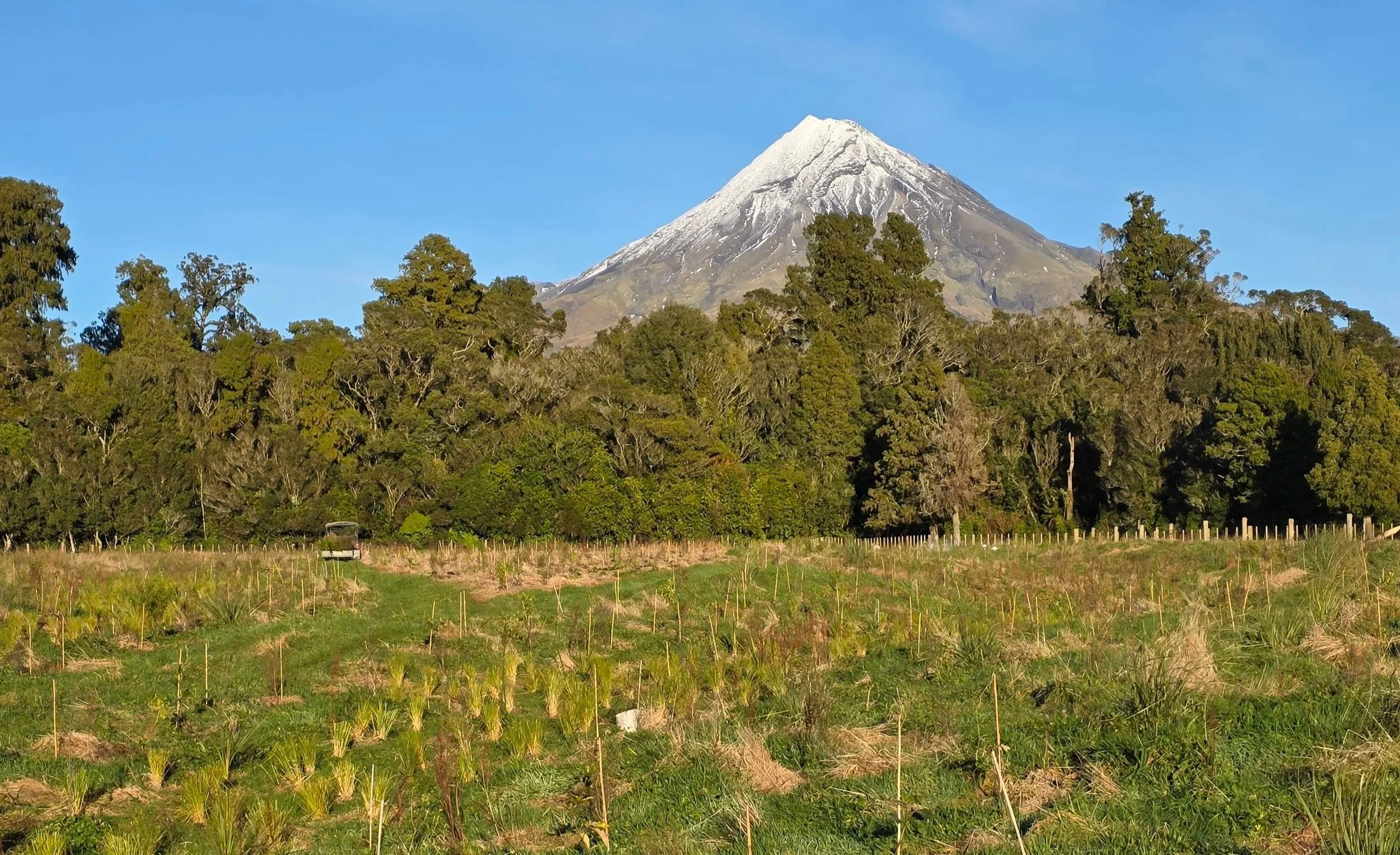
Te Ihowai team connecting people and place during a planting day.
The Future
With the successful integration of Navigator and Navigator X, the Taranaki Mounga Project team is looking to continue meaningful, collaborative restoration initiatives across the region. The project's approach serves as a model for other regions aiming to combine scientific tools with local insights for effective biodiversity restoration.
Interested in enhancing your restoration efforts with data-driven tools? Contact Eco-index to learn how Navigator and other solutions can support your biodiversity goals.
Interested in restoration initiatives in Taranaki? Check out the Taranaki Mounga website for lots more.